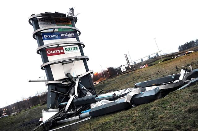
Storm hits central Scotland


The Met Office have issued an Amber ‘Be Prepared’ warning covering most parts of Scotland including Cumbernauld and Kilsyth which is effective from 2am to 4pm today, with the worst of the impacts expected in the period up to mid-day, with wind speeds likely to exceed 80mph in some places.
The Scottish Environment Protection Agency (SEPA) have also issued a number of Flood Alerts and Warnings, with a focus on potential coastal flooding on east and west coasts through Thursday and into Friday.
Advertisement
Hide AdAdvertisement
Hide AdThe Scottish Government’s Resilience operation has been activated to liaise with authorities and organisations across the country and to co-ordinate any activity as required.
Ministers are being kept fully briefed on developments.
The forecast conditions are already having an impact on transport and travel for Thursday morning.
Police Scotland have advised drivers that from early morning, and throughout the rush-hour period (7am to 9am), the conditions for road travel are likely to be extremely poor and there is a high risk of disruption for road journeys across Scotland, particularly in the west.
Police have warned drivers that if they do travel, they are likely to experience significant delays due to high winds and driving rain creating surface water and an increased risk of flash flooding on many roads.
Advertisement
Hide AdAdvertisement
Hide AdTransport Scotland, whose Multi-Agency Control Centre operated overnight, have said that the forecast windspeeds could have a particular impact on Scotland’s major bridges, which may result in them being closed to traffic for periods when the highest gusts are experienced in the run up to and during the morning peak period.
Network Rail, who will have hundreds of engineers out across the network ready to react to problems and clear fallen trees, have tonight told commuters that service levels and speeds will being reduced as a safety precaution when winds are at their peak.
Passengers should check before they travel, as some routes and stations will not be served today until the worst of the gale force winds have passed.
Ferry operator Caledonian MacBrayne have said that the forecast is looking particularly severe for the morning and are advising all ferry travellers to take this into account when planning journeys in the next few days.
Advertisement
Hide AdAdvertisement
Hide AdAir passengers are advised to check with airports and airlines before travelling.
Power companies are also monitoring the forecasts carefully and have engineers ready to take action across the country to deal with any power line issues or general supply disruption.
Local Authorities across the country have in place their usual arrangements for dealing with severe weather, working with relevant partners.
Scottish Government Transport Minister Keith Brown, said: “The Scottish Government and Transport Scotland are working closely with transport operators, the Met office, Police Scotland, SEPA and many other agencies and organisations to make sure that the most useful and up to date information is given to those who need it most.
Advertisement
Hide AdAdvertisement
Hide Ad“We have held a number of meetings with key partners already and both the Scottish Government Resilience Room (SGoRR) and Transport Scotland’s multi-agency response team (MART) will be operational overnight.
“I would urge the travelling public to consider the conditions before they set-off on their journeys. Indications are that bridges across the country will be affected by the strong winds and closures are expected during the morning peak period.
“People should listen to radio reports or visit the Traffic Scotland website or twitter feed, and carefully consider police advice.
“Trains and ferries will also be disrupted and operator websites will have the latest information.”